Probabilistic Tsunami Design Zone Maps for the State of Hawaiʻi
Introduction
The Coastal Zone Management Program developed high-resolution probabilistic Tsunami Design Zone maps compatible with American Society of Civil Engineers (ASCE) 7-16 for the State. The Tsunami Design Zone maps depict the extent of tsunami impacts, and are used by engineers, architects, and designers to determine which structures need to be designed to withstand tsunami forces. The tsunami design zone provisions apply to structures classified as Risk Category III (examples include buildings that pose a substantial hazard to human life in case of failure, including schools, places of assembly, buildings where more than 300 people gather, buildings with daycare facilities for more than 150 children, and buildings with a capacity of over 5,000 people) and Risk Category IV (examples include buildings that are essential for emergency response and essential services, including hospitals, fire stations, police stations, emergency shelters, emergency operations centers, power-generating stations, water treatment facilities, and buildings containing hazardous materials). The probabilistic Tsunami Design Zone maps allow for more accurate mapping and modeling, and will mitigate tsunami hazards and strengthen Hawaiʻi’s essential facilities and critical infrastructure, leading to a more resilient Hawaiʻi.
Project Background
The Hawaiʻi Multi-Hazard Mitigation Plan identifies tsunamis as a significant hazard, posing a high coastal hazard risk across the State of Hawaiʻi. Tsunamis can cause an estimated average annual loss of $168 Million / Year (HI-EMA, 2013. p. 19-56). Despite the risk, there are no national standards for designing critical facilities to withstand tsunami loads and impacts.
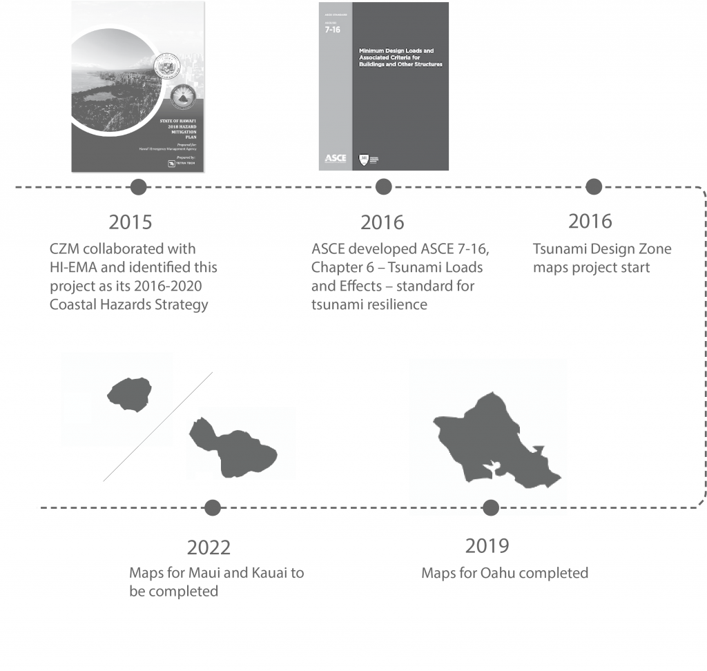
In 2016, the American Society of Civil Engineers (ASCE) developed ASCE 7-16, Chapter 6 – Tsunami Loads and Effects – the first national, consensus-based standard for tsunami resilience in Alaska, Washington, Oregon, California, and Hawaiʻi.
The development of probabilistic Tsunami Design Zone maps is a multi-year process covering Oʻahu, Maui, and Kauaʻi, and is anticipated to culminate in changes to county building codes for the safety and future resiliency of Hawaiʻi.
To bridge the gap that ASCE identified, the Coastal Zone Management Program has led the development of Tsunami Design Zone maps in alignment with the priorities identified in the State’s Multi-Hazard Mitigation Plan. In 2015, the CZM Program collaborated with HI-EMA and identified this initiative as part of CZM’s 2016-2020 Coastal Hazards Strategy, which was approved by the National Oceanic and Atmospheric Administration Office for Coastal Management (NOAA OCM).
These maps will facilitate the adoption of tsunami provisions by State and local jurisdictions in their respective building codes. This statewide initiative enables the State Building Code Council and the ASCE-7 to adopt the Tsunami Design Zone maps in the application of the code, and will result in increased tsunami resilience.
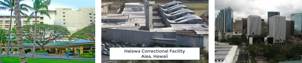
Essential facilities from left: Queens Medical Center, Halawa Correctional Facility, Honolulu High-rise
Project Overview
Part of the statewide initiative to advancing tsunami resilience is to develop probabilistic Tsunami Design Zone mapping for the state using higher order modeling and mapping for better accuracy and higher resolution. The probabilistic mapping models the probability of a 2,500-year tsunami event. The maps would inform engineers and experts on how best to design essential facilities, critical infrastructure, and taller buildings within the Tsunami Design Zone to be able to withstand tsunami loads and impacts.
The project outcome also proposes draft amendments for each county’s building codes to adopt the probabilistic Tsunami Design Zone maps and model data developed along with styles of maps appropriate for use in their building codes and the ASCE Tsunami Design Geodatabase.
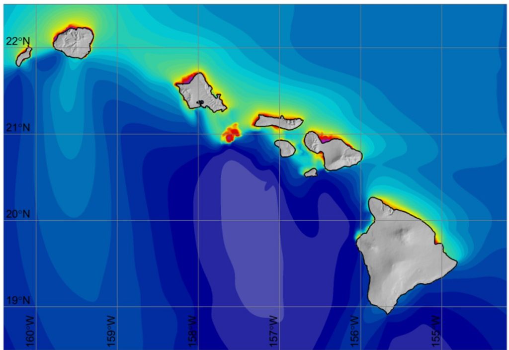
Maximum Wave Amplitude in Hawaiʻi using NEOWAVE, a model used for probabilistic tsunami modeling
Project Timeline
Additional Information about the Project
Hawaii Public Radio Feb. 4, 2019 Article with Audio Interview
Link to ASCE-7 Tsunami Hazard Tool
Sign Up To Get Updates
If you’re interested in being notified about Project milestones, please subscribe to the Office of Planning and Sustainable Development’s newsletter.